
A view of the island from the ferry: about 3km long and 2km wide, the island of Port Cros is the smallest of a set of three islands called the "Golden Islands", or "Iles d'Or". Protected as a national park since the 60s, the island is a veritable walking paradise: no cars, no construction, no smoking -- only a set of beautiful walking paths carved into the rocky coastlines and island interior.

Here is the island port: a tiny set of of homes and a year-round population of only 30. Construction on the island completely stopped when it was converted into a park. You can find a handful of restaurants and bars here to have a bite or a drink once you've finished exploring the island.

Even the waters are protected in this National Park: no fishing allowed. This picture below was taken by the main port. These guys were looking for pieces of baguette thrown into the waters by a group of schoolchildren:

Here is one of the few pre-Napoleonic forts on the island, built to protect France's southernmost outpost against invaders, such as the English (no offence)

Leaving the port, the wilderness becomes untamed and the waters crystal clear. In this picture an Aleppo pine stands proudly by the coastline...

There are two classic walking options on the island: an eastern or western loop, both lasting about 4 hours. I began on the eastern portion, slightly more challenging. Steps are carved into the hillside -- as seen below -- carrying you quickly above sea level and back down.

Shaded by giant cork trees and dense vegetation, the island is a reminder that Mediterranean forest can be lush when left to its own devices. On the mainland the vegetation is mostly composed of brush due the continuous depletion of soils

Too eager to take pictures, this guide forgot to watch his footing and had a fight with a boulder -- and lost...

On the north side of the island, facing the mainland, the paths remain close to sea level, making it easier to observe the pristine waters

Here is another shot of the coastline path along the eastern loop. Since the island only attracts walkers -- not the beachgoers of the mainland -- you can often walk for hours without seeing a single person. As was the case for me today.

You can take the time to explore the beautiful inlets...

Speaking of beautiful inlets, here's a little video...
It's early May and flowers are out in full force. Below are: wild lavender, Hottentot fig, thistle, cistus, asphodele.


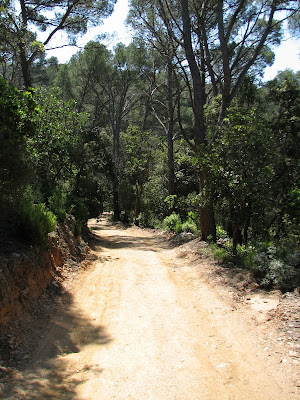
Heading back toward the west, an easy path on a wide track leads the way: a soothing portion to ease the knees after all those steps.
I saw many uprooted pine trees along the way: this past winter there were some major storms and some of the trees, having shallow root systems in their Mediterranean soils, did not resist...

The ruins of the building called La Sardinière in the island interior, slowly being taken over by plants and trees...

A final climb on the west side of the island leads to its 200m summit -- Mont Vinaigre -- from where the picture below was taken. I found my lunch spot here, under the shade of an arbutus tree.

The southern slopes seen here are much more jagged than on the north: a beautiful path runs on a shelf high above the sea, with outstanding and far-reaching views.

The shaded paths leading back down towards the port are soft underfoot...

After some rains this Spring, this valley path was blanketed by a stream, which will dry by the summer....

blog you later,
Stuart